HOW TO GET TO THE LOIRE VALLEY MSH ?
By train
To prepare your trip, you can also consult the SNCF website.
What you need to know:
Tours has two main stations – Tours Centre and St-Pierre-des-Corps. Most high-speed ‘TGV’ trains stop at St-Pierre-des-Corps and there is then a shuttle to Tours Centre station.
You then have the choice of taking public transport or a taxi.
By public transport
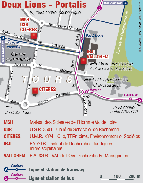
Come out of Tours Centre station and go to the “Gare de Tours” tram stop which is on your left when leaving the station.
Take the TRAM A line in the direction of “Lycée Jean Monet“. Get off at the “Heure Tranquille” stop. To walk to the MSH on foot, walk back in the direction the tram came for about 30 metres to 33 rue Ferdinand de Lesseps (next to the entrance to the ‘Aménagement‘ Department of the University of Tours’ École Polytechnique).
Come out of St-Pierre-des-Corps station and go to the bus stop “St Pierre gare” opposite the station.
Take line 05 in the direction of “Parc Grandmont“. Get off at the “Fac 2 Lions” bus stop which takes about 50 minutes by bus. Walk along the Faculté de Droit on Avenue Portalis then turn right into Allée Ferdinand de Lesseps where the tram tracks are located. The MSH is on your right at the corner of Allée Ferdinand de Lesseps and rue James Watt opposite one of the entrances to the “L’Heure Tranquille” shopping centre.
If you require any more information please consult the Fil Bleu website.
By taxi
- Taxis Radio Tours: 02.47.20.30.40
- Al Taxi: 02.47.41.01.01
- Allo Taxi: 06 88 03 87 41 (wheelchair access)
- Taxi Cortassa: 02.47.80.94.76 (Joué-les-Tours)
By car
Take the A10 motorway, leave at exit 22 (Saint-Avertin) and follow the direction of the quartier des Deux-Lions.
A car-park is at your disposal on the site.
GPS coordinates: 47.367077, 0.68065
Sur l’autoroute A10, prendre la sortie n°22 (Saint-Avertin), puis la direction du quartier des Deux-Lions.
Sur place, un parking est à votre disposition.
Coordonnées GPS : 47.367077, 0.68065
By plane
Tours airport is located 6 km north-east of Tours and offers regular flights to Marseille, London Stansted, Dublin and Porto. Timetables are available on the ‘Aéroport International Tours – Val de Loire’ website or from your travel agent
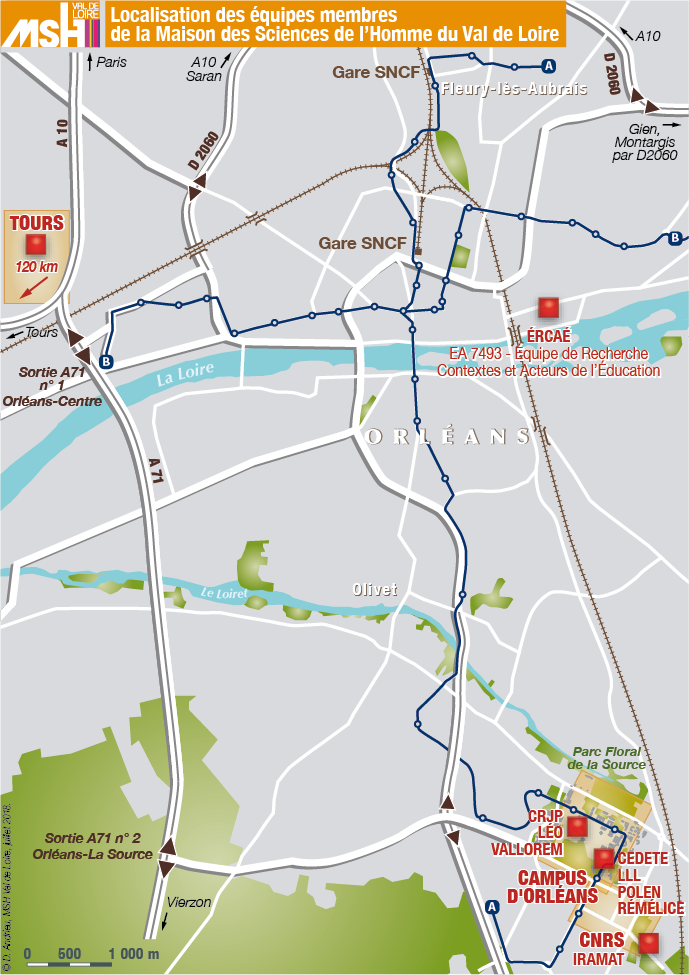
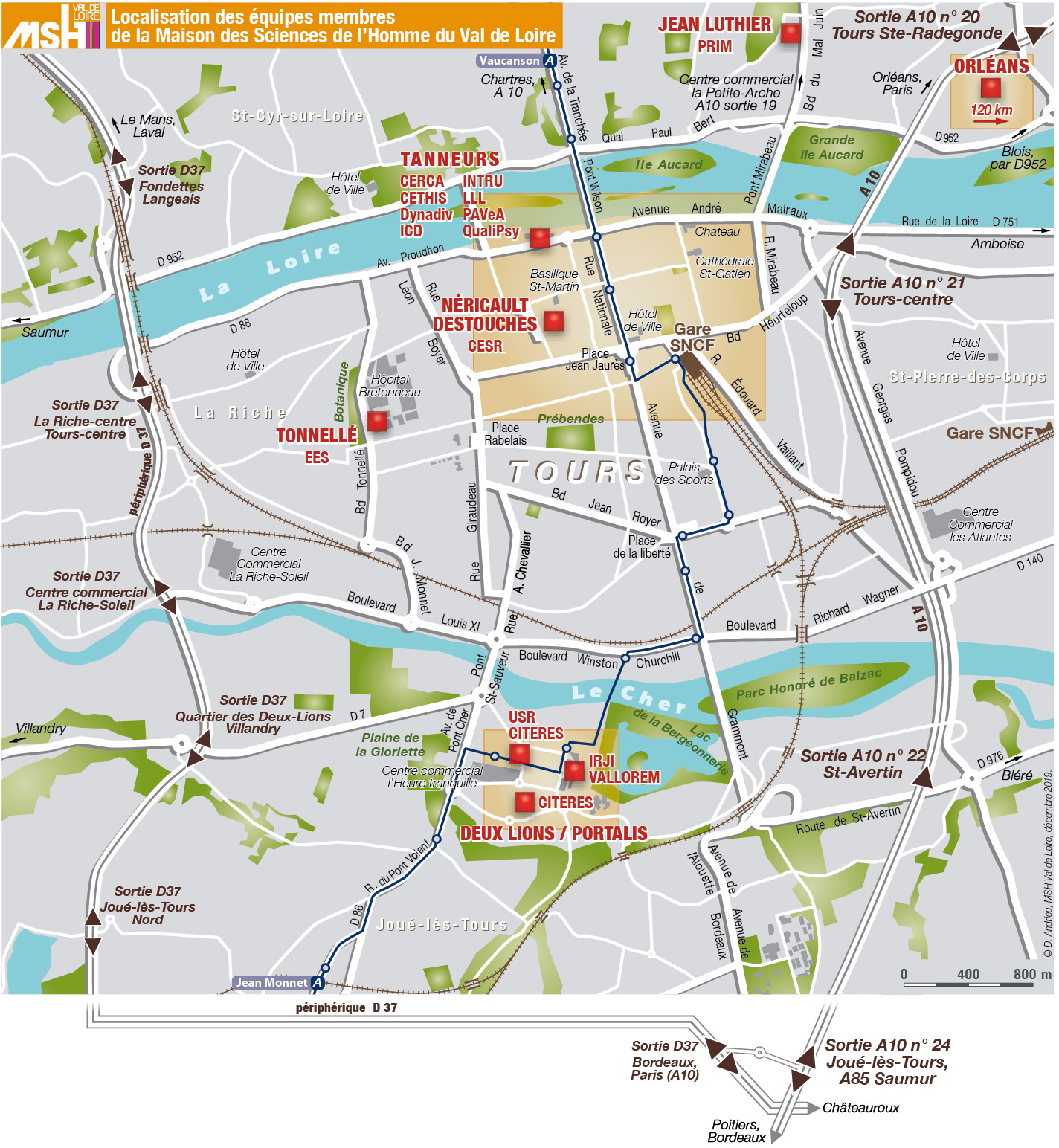
The Loire Valley MSH’s location
To locate the MSH teams
Tours – Overall map
The Tours teams located in the Deux Lions neighbourhood
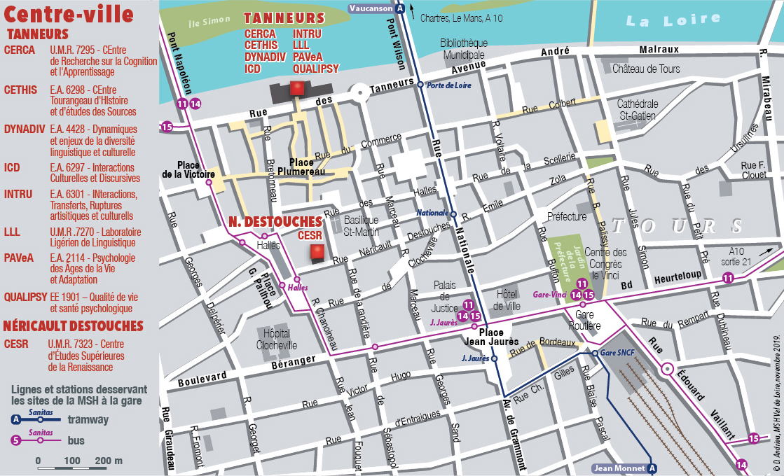
The Tours teams located in the town centre
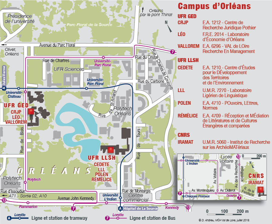
The Orléans teams located at La Source
Orléans – Overall map